
About Piedra Basin
 The Piedra Basin is the least-developed basin within the Southwest Basins Roundtable area because it has the least amount of private land. Most of the Piedra Basin is U.S. Forest Service or Southern Ute Tribal land with small areas of private land in the upper and lower drainage. The majority of the private land is located in the Stollsteimer Creek drainage, which is a tributary of the Piedra River, with the confluence about 5 miles upstream from the New Mexico state line. The Stollsteimer Creek drainage includes most of the area served by the Pagosa Area Water and Sanitation District (PAWSD) and essentially all of the population within the Piedra drainage. The flow in Stollsteimer Creek is primarily diversions from the San Juan River by PAWSD to provide municipal water to its customers. The Piedra River is not large enough for rafting except during runoff and is mostly known for fishing.
Piedra Basin Projects Information
Use the following tabbed information to explore water project information addressing Piedra Basin's water needs.
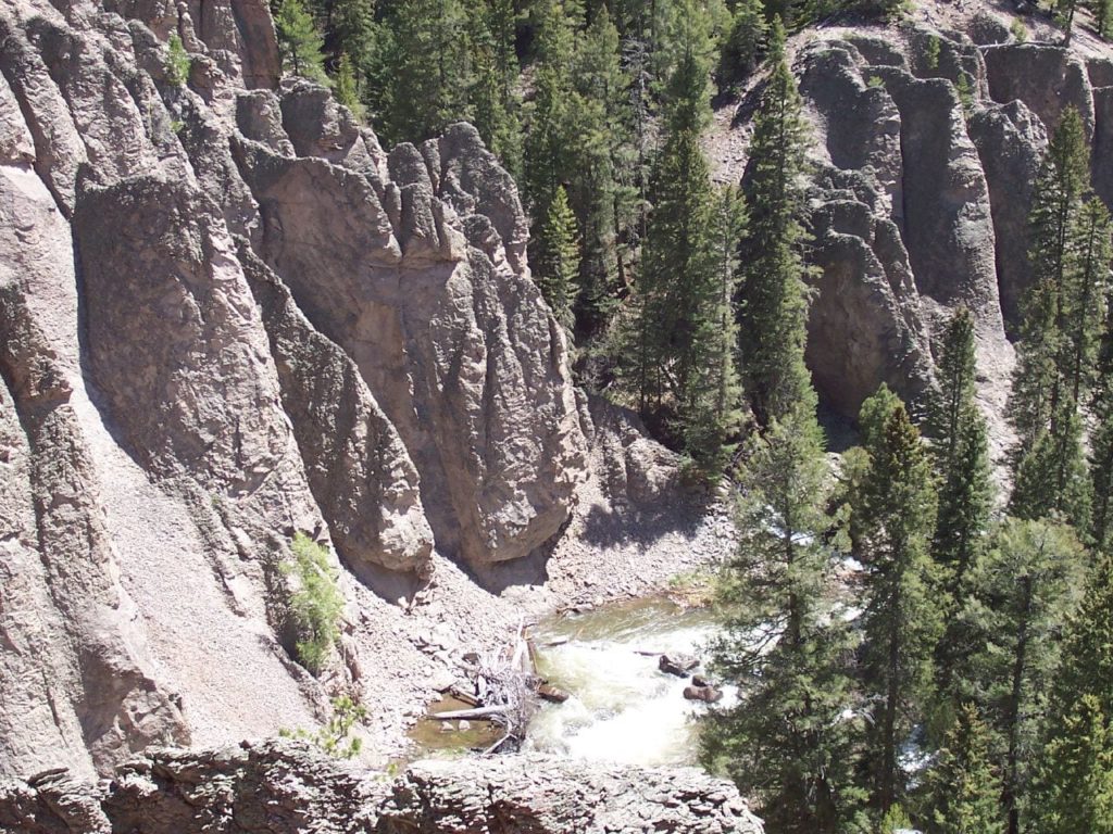
Sub Basin Map
Demand, Supply, and Potential Water Needs
Municipal and Industrial Demand, Supply, and Potential Water Needs
The Technical Update to the Colorado Water Plan (Referred to herein as the Technical Update) estimated the population of the Southwest Basin to be about 2 percent of the statewide population, which was about 108,000 people in 2015. Population in the Southwest Basin is projected to grow to between 130,000 and 280,000 people between 2015 and 2050.
The Southwest Basin’s average 2015 Baseline per capita system demand is approximately 198 gallons per capita per day (gcpd). Sources of water demand data, such as Senate Bill 1051 or Municipal Water Efficiency Plans (WEP), made up 48 percent of available information (reference the Technical Update, Section 4.9.5 Municipal and Self-Supplied Industrial Diversion Demands, page 165).
The Southwest Basin’s municipal demands were approximately 24,000 acre-feet per year (AFY) in 2015, which is projected to increase to between 26,000 and 63,000 AFY in 2050. The Southwest Basin’s industrial demands are minimal, with a 2015 Baseline demand of 2,280 AFY, which also is projected to increase to between 3,940 to 4,720 AFY in 2050.
For a detailed explanation of the methodologies used for estimating municipal and industrial (M&I) demands and gaps, reference the Technical Update Volume 1, Section 2.2.4 M&I Demands. For further information about the Southwest Basin’s M&I demands, reference the 2021 BIP Volume 1.
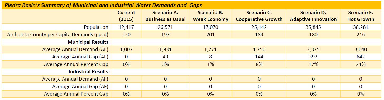
Archuleta County, which encompasses both the San Juan and Piedra rivers, had a population of about 12,400 in 2015, which was about 11 percent of the total Southwest Basin’s population. This county’s population is expected to increase in all planning scenarios, ranging from just 37 percent under Scenario B to a 208 percent increase under Scenario E.
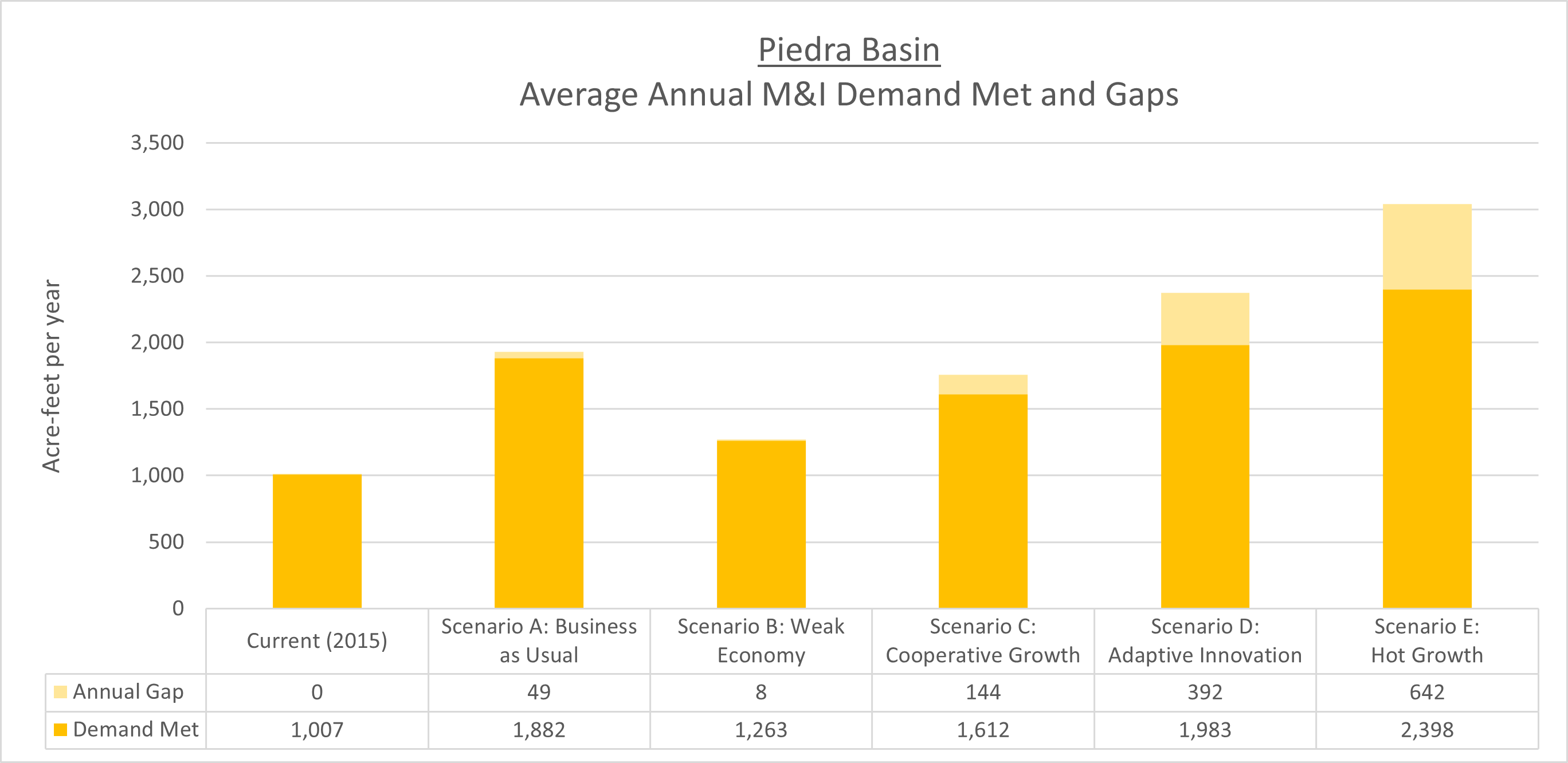
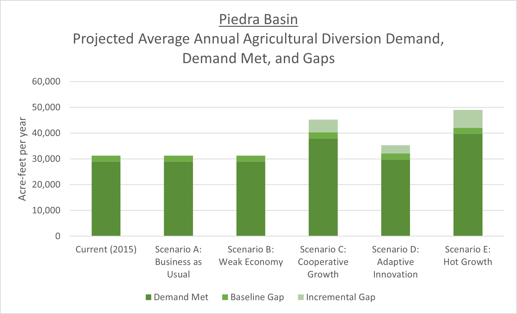
The above table describes the population, M&I demands, and M&I gap results. These results show the average annual demand and gap increases for each scenario. Table results are depicted in the below figure. This figure sums the total average annual demand and gap for each scenario.
 One tool was developed during the Technical Update to evaluate future risks to environmental and recreational needs at a cursory level. This tool, the Watershed Flow Evaluation Tool (WFET), was built on the NCNA efforts previously described. The WFET is intended to assess risks that stream-based ecological resources may change as a result of climate change, human uses, and/or the diversion of water. This tool is not intended to replace on the ground site-specific assessments (Technical Update, 2017, Volume 2, Section 6-1.2 Colorado Environmental Flow Tool Documentation, page 6).