About San Juan Basin
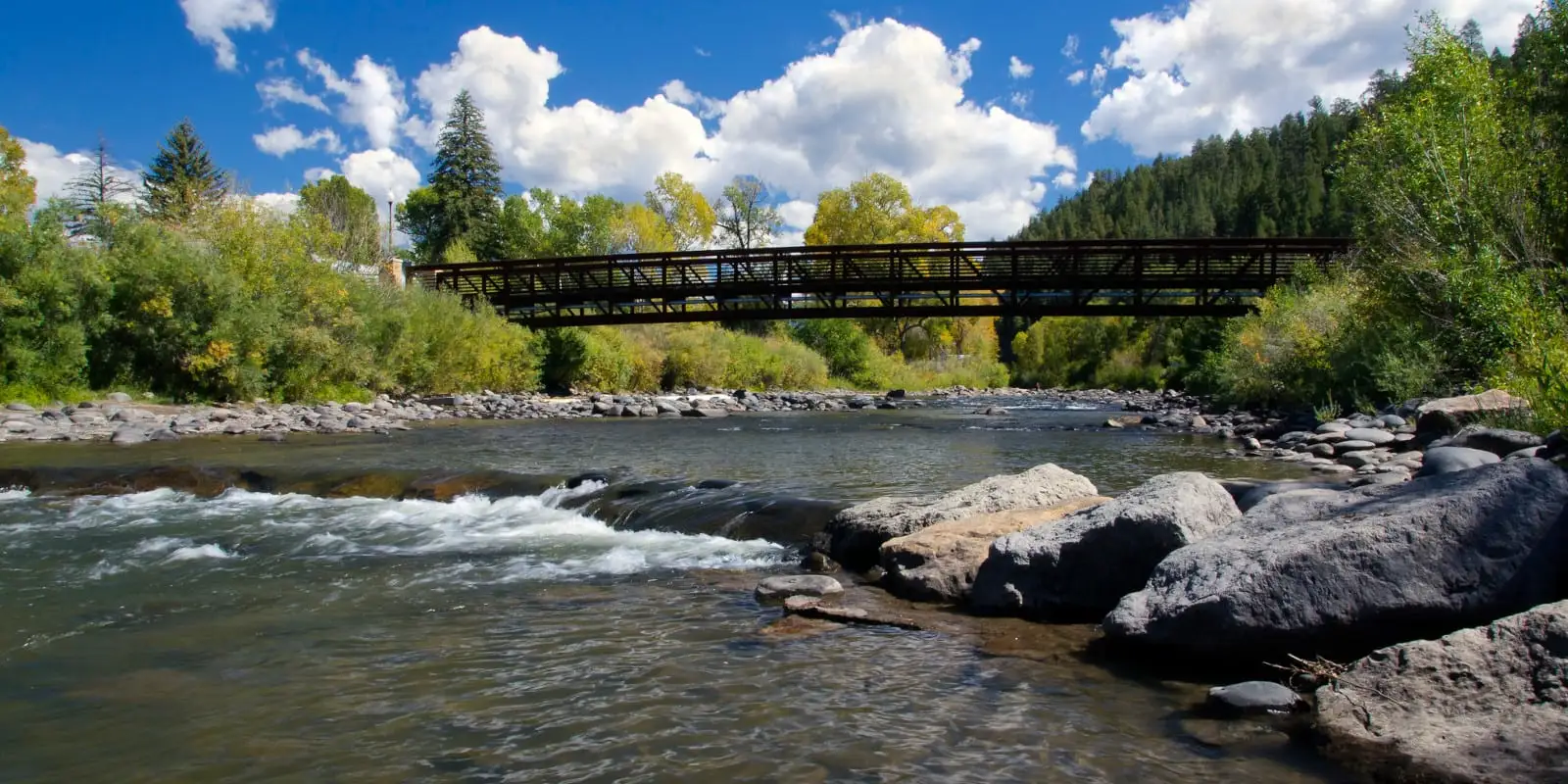 Within Colorado, the San Juan Basin supports the communities of Pagosa Springs and the surrounding rural areas. Approximately 14,300 acres within the San Juan watershed are irrigated grass pasture. The San Juan River begins at the headwaters of the East and West forks in the eastern San Juan Mountains in the San Juan National Forest. The river’s mainstem begins at the confluence of the two forks then flows southwest through Pagosa Springs and reaches Navajo Reservoir just north of the New Mexico border. The river encompasses approximately 1,528 square miles in Colorado and flows a total of 383 miles from the headwaters to Lake Powell.
The San Juan Basin is the source for the Southwest Basin’s major trans-mountain diversion, the San Juan Chama Project. The San Juan Chama Project diverts water from the Navajo, Little Navajo, and Blanco rivers in the San Juan Basin in Colorado to the Rio Grande River in New Mexico to provide a portion of New Mexico’s Colorado River entitlement. The average annual diversion ranges from 85,000 to 100,000 acre-feet (AF). These New Mexico obligations are met by the San Juan Basin and affect the water available to meet the current and future water needs of the area’s communities.
Recreation possibilities in the San Juan Basin include rafting through Pagosa Springs, visiting developed and undeveloped hot springs along the West Fork and San Juan rivers, and numerous fishing opportunities. The San Juan Basin includes a small subbasin that is home to a unique genetic linage of Colorado River cutthroat trout that was long thought to be extinct but were discovered in 2018 by Colorado Parks and Wildlife. The San Juan River and its tributaries have 17 decreed instream flows.
San Juan Basin Projects Information
Use the following tabbed information to explore water project information addressing San Juan Basin's water needs.
Sub Basin Map
Demand, Supply, and Potential Water Needs
Municipal and Industrial Demand, Supply, and Potential Water Needs
 The Technical Update to the Colorado Water Plan (Referred to herein as the Technical Update) estimated the population of the Southwest Basin to be about 2 percent of the statewide population, which was about 108,000 people in 2015. Population in the Southwest Basin is projected to grow to between 130,000 and 280,000 people between 2015 and 2050.
The Southwest Basin’s average 2015 Baseline per capita system demand is approximately 198 gallons per capita per day (gcpd). Sources of water demand data, such as Senate Bill 1051 or Municipal Water Efficiency Plans (WEP), made up 48 percent of available information (reference the Technical Update, Section 4.9.5 Municipal and Self-Supplied Industrial Diversion Demands, page 165).
The Southwest Basin’s municipal demands were approximately 24,000 acre-feet per year (AFY) in 2015, which is projected to increase to between 26,000 and 63,000 AFY in 2050. The Southwest Basin’s industrial demands are minimal, with a 2015 Baseline demand of 2,280 AFY, which also is projected to increase to between 3,940 to 4,720 AFY in 2050.
For a detailed explanation of the methodologies used for estimating municipal and industrial (M&I) demands and gaps, reference the Technical Update Volume 1, Section 2.2.4 M&I Demands. For further information about the Southwest Basin’s M&I demands, reference the 2021 BIP Volume 1.
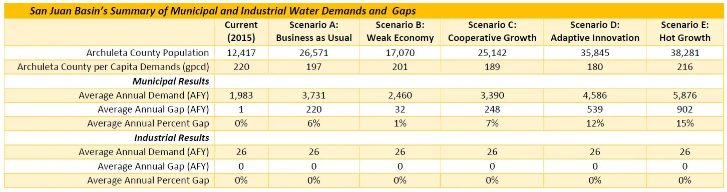
Archuleta County, which encompasses both the San Juan and Piedra rivers, had a population of about 12,400 in 2015, which was about 11 percent of the total Southwest Basin’s population. This county’s population is expected to increase in all planning scenarios, ranging from just 37 percent under Scenario B to a 208 percent increase under Scenario E.
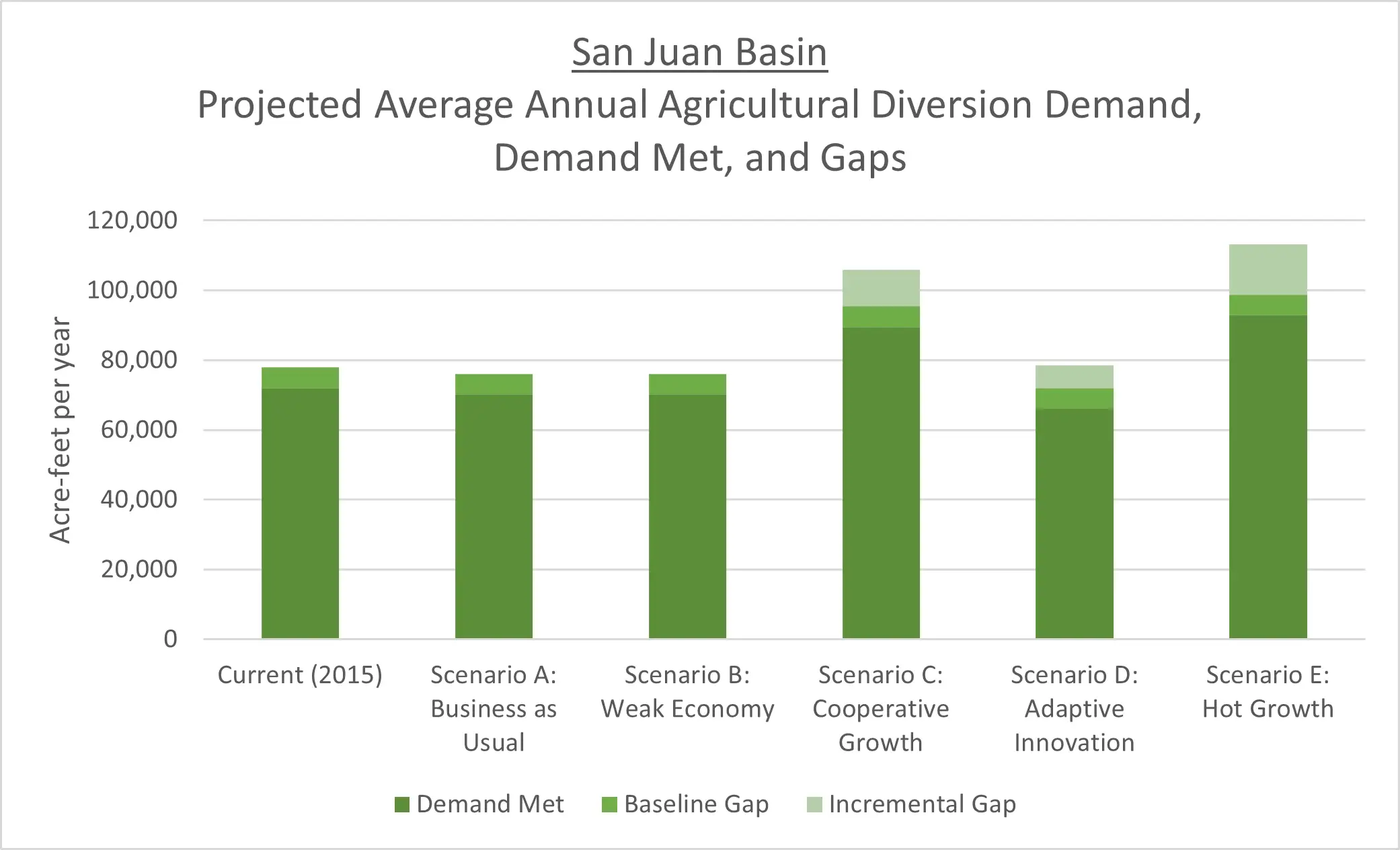
The above table describes the population, M&I demands, and M&I gap results. These results show the average annual demand and gap increases for each scenario. Table results are depicted in the below figure. This figure sums the total average annual demand and gap for each scenario. Additional information and analyses on municipal demands in the Upper San Juan Basin are presented in Wilson Water Group (2021).” Citation: Wilson Water Group. 2021. Final Technical Report Memorandum: West Fork Water Rights Alternative Study (available on www.sjwcd.org)

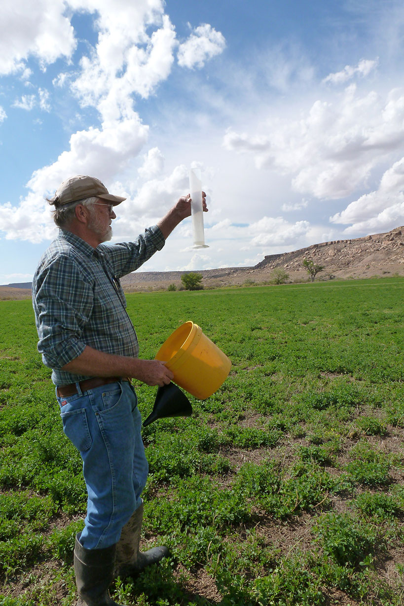 The Technical Update defines the current agricultural diversion demand as the amount of water that needs to be diverted or pumped to meet the full crop irrigation water requirements associated with current levels of irrigated acreage, assuming historical climate conditions. Current demand serves as the “baseline” for the Technical Update analysis and can be used to estimate the change from current to future conditions. To estimate potential future diversion demands, irrigated acreage, climate conditions, and efficiencies associated with the current agricultural diversion demand were adjusted by various factors to estimate the demands associated with the five planning scenarios that serve as the basis for the Technical Update analyses (Technical Update, 2017, Volume 1, Section 2.2.3 Agricultural Diversion Demands, page 13).
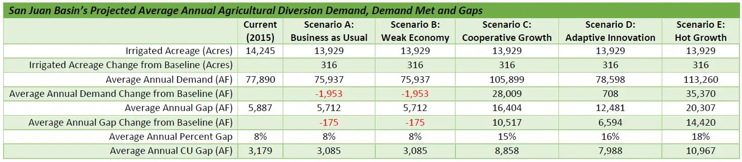
 There are significant gaps in the data and understanding of flows and other conditions necessary to sustain the Southwest Basin’s environmental and recreational uses. The Southwest Basins Roundtable also recognizes that the tools currently available to help maintain those conditions are limited. The Southwest Basins Roundtable has identified two methods to address and bridge this need for additional information and tools. These are: