About San Miguel Basin
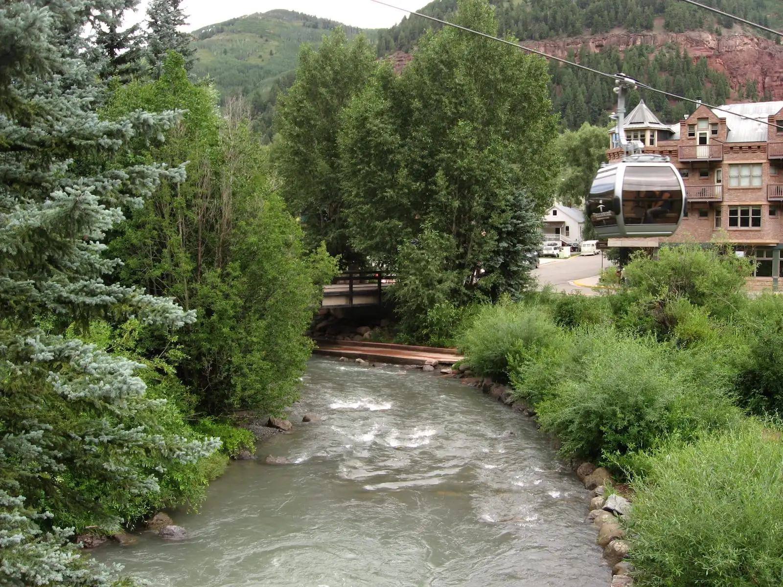 The San Miguel River begins southeast of Telluride in the San Juan Mountains and flows northwest along the southern slope of the Uncompahgre Plateau until joining the Dolores River. It encompasses approximately 1,550 square miles and flows about 80 miles from the headwaters to the Dolores River.
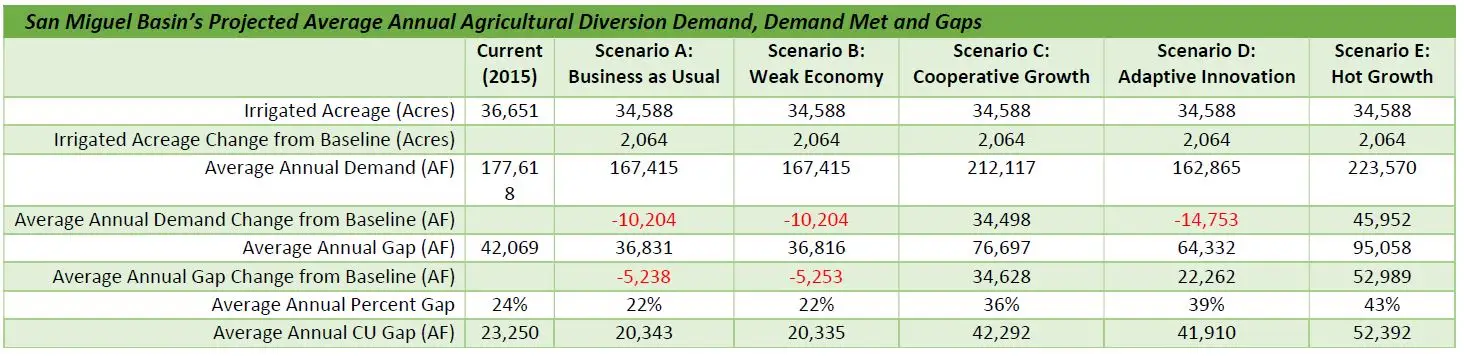
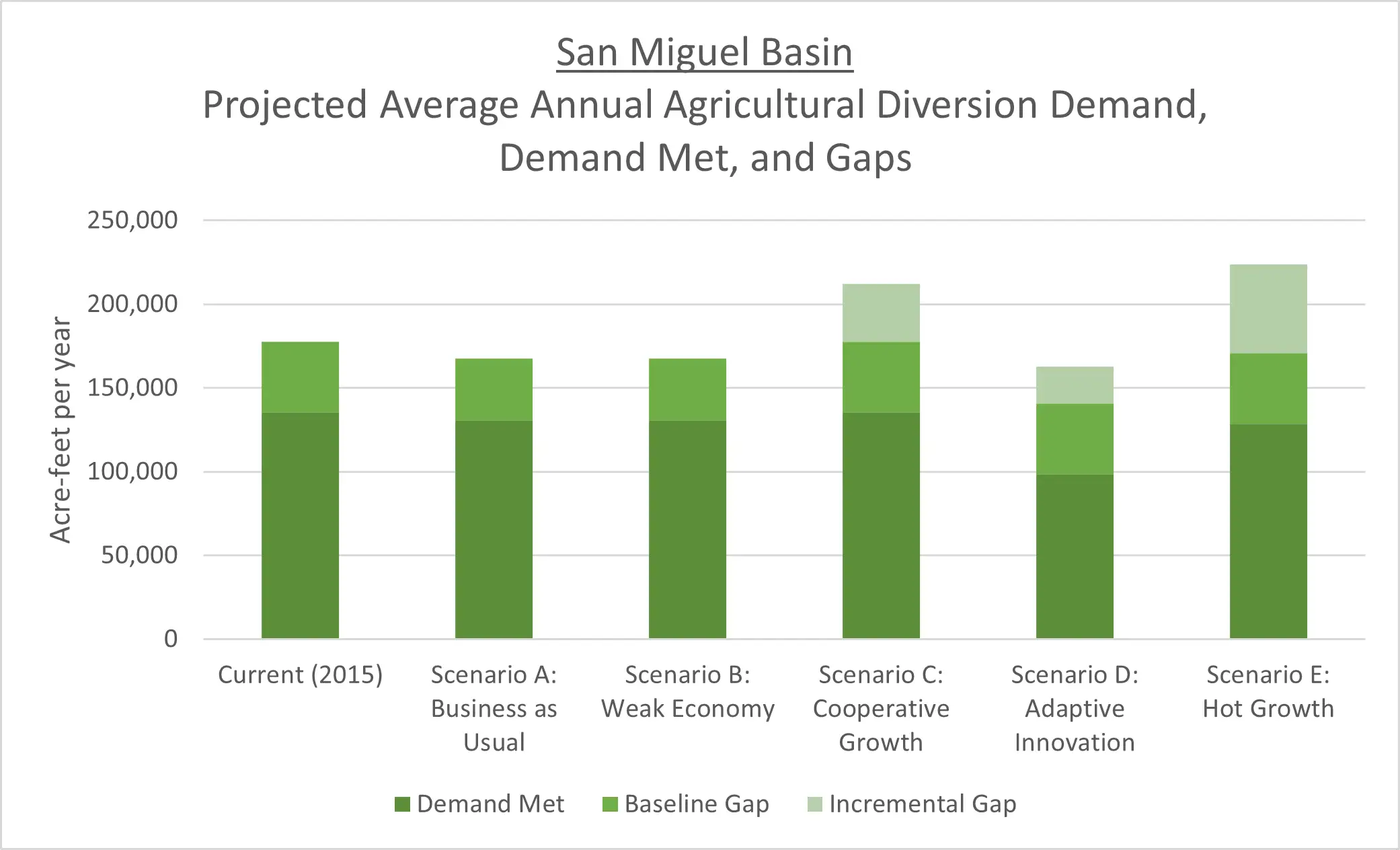
The San Miguel Basin supports the communities of Telluride, Mountain Village, Nucla, Naturita, Norwood, and surrounding rural areas. The San Miguel watershed irrigates about 36,700 acres of mostly grass pastures. Many of these irrigated acres are served by one of the 20 jurisdictional reservoirs in the basin.
Recreation possibilities in the San Miguel Basin include rafting, skiing, fishing, camping, biking, and hunting. The San Miguel River and its tributaries have 44 decreed instream flows. Stakeholder-driven groups strive to improve and restore the riparian corridor up and down the river.
San Miguel Basin Projects Information
Use the following tabbed information to explore water project information addressing San Miguel Basin's water needs.
Sub Basin Map
Demand, Supply, and Potential Water Needs
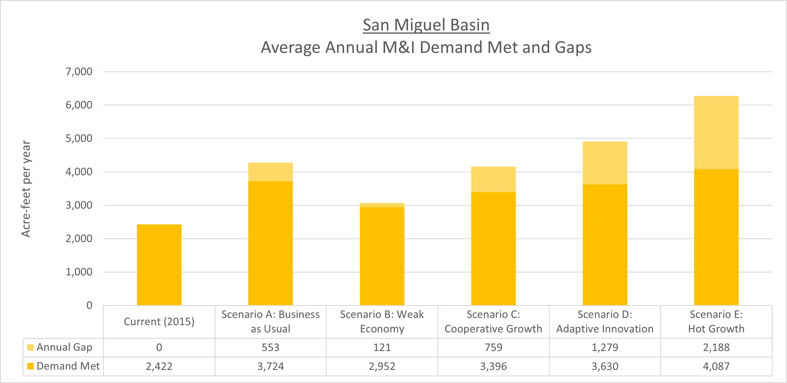
Municipal and Industrial Demand, Supply, and Potential Water Needs
The Technical Update to the Colorado Water Plan (Referred to herein as the Technical Update) estimated the population of the Southwest Basin to be about 2 percent of the statewide population, which was about 108,000 people in 2015. Population in the Southwest Basin is projected to grow to between 130,000 and 280,000 people between 2015 and 2050.
The Southwest Basin’s average 2015 Baseline per capita system demand is approximately 198 gallons per capita per day (gcpd). Sources of water demand data, such as Senate Bill 1051 or Municipal Water Efficiency Plans (WEP), made up 48 percent of available information (reference the Technical Update, Section 4.9.5 Municipal and Self-Supplied Industrial Diversion Demands, page 165).
The Southwest Basin’s municipal demands were approximately 24,000 acre-feet per year (AFY) in 2015, which is projected to increase to between 26,000 and 63,000 AFY in 2050. The Southwest Basin’s industrial demands are minimal, with a 2015 Baseline demand of 2,280 AFY, which also is projected to increase to between 3,940 to 4,720 AFY in 2050.
For a detailed explanation of the methodologies used for estimating municipal and industrial (M&I) demands and gaps, reference the Technical Update Volume 1, Section 2.2.4 M&I Demands. For further information about the Southwest Basin’s M&I demands, reference the 2021 BIP Volume 1.
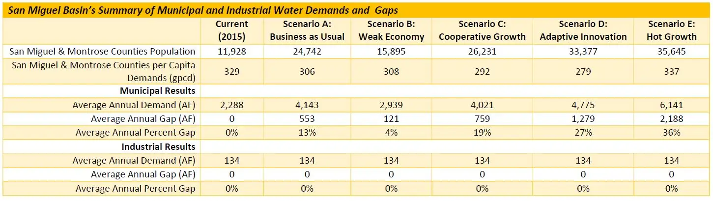
San Miguel County, which encompasses the San Miguel River and portions of the Dolores River, had a population of about 7,800 in 2015, which was about 7 percent of the total Southwest Basin’s population. This county’s population is expected to increase in all planning scenarios, ranging from just 42 percent under Scenario B to a 218 percent increase under Scenario E.
Montrose County, which encompasses portions of the San Miguel and the Dolores rivers, had a population of about 4,000 in 2015 within the boundaries of these two watersheds, which was about 4 percent of the total Southwest Basin’s population. This county has population in both the Southwest and Gunnison basins, with only a portion of the population attributed to the Southwest Basin. This county’s population is expected to increase in all planning scenarios, ranging from just 17 percent under Scenario B to a 163 percent increase under Scenario E.